Introduction
In the competitive markets of Bellevue and the greater Puget Sound, standing out is essential. One of the most effective ways to do that? Real estate aerial photography. High-quality drone imagery offers potential buyers a unique perspective of a property, capturing everything from the roofline to the surrounding neighborhood. In this blog, we’ll explore how aerial real estate photography enhances listings and why top agents are using it to close faster and sell smarter.
Sections
- What Is Real Estate Aerial Photography?
- Why Aerial Imagery Sells Homes
- Best Properties for Drone Photography
- How Bellevue Agents Use Aerial Photography
- Aerial Photography for Real Estate Agents: What to Expect
- Book Your Aerial Shoot Today
What Is Real Estate Aerial Photography?
Real estate aerial photography refers to the use of drones to capture images of a property from above. It includes wide shots of the land, top-down images, and cinematic flyovers. At Clarity Northwest, our aerial photography for real estate services are designed specifically for agents, builders, and developers who want to highlight a home’s scale, setting, and outdoor features.
Why Aerial Imagery Sells Homes
According to REALTOR® Magazine, listings with drone photography get more views and generate more interest. Why? Because they tell a story that static ground-level images can’t. Aerial real estate photography offers buyers an immersive sense of place—showing not just what a home looks like, but where it lives. In today’s visual-first world, drone photography gives listings a clear competitive edge.
Buyers scrolling through dozens of listings will pause when they see sweeping views of a property’s exterior, landscaping, and neighborhood context. This is especially true in high-end real estate, where luxury homes deserve luxury visuals. Whether highlighting a property’s position on a quiet cul-de-sac or its stunning view of the Puget Sound, aerial photos do more than impress—they inform. They allow potential buyers to evaluate surroundings, privacy, and scale, all within a single frame.
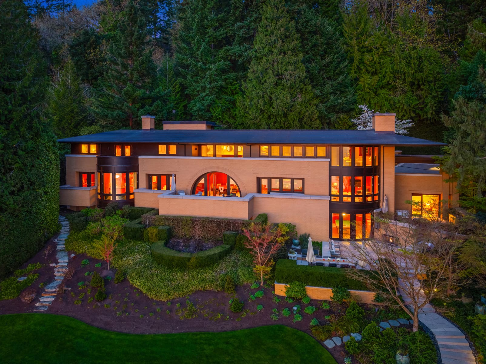
Best Properties for Drone Photography
- Large estates with extensive land or multiple buildings
- Waterfront homes that benefit from capturing shoreline angles
- Homes with unique architecture best appreciated from above
- New developments or lots with proximity to community features
- Commercial real estate and luxury properties with curb appeal
How Bellevue Agents Use Real Estate Aerial Photography
Top Bellevue photographers and agents use drone images for everything from listing pages to print brochures and social media reels. In a high-demand market, it’s the small touches—like a breathtaking aerial sunset shot—that can spark a showing. Bellevue photography clients count on aerial views to highlight proximity to parks, schools, trails, and city amenities.
Real Estate Aerial Photography for Agents: What to Expect
When you book a shoot with Clarity, our licensed drone pilots handle everything from permits to post-production. Our real estate aerial photography package includes:
- High-resolution still images
- Cinematic flyover video (if requested)
- Optimized files for MLS, social media, and web
- Fast turnaround and easy download access
We tailor each shoot to your specific property and marketing needs. Whether you’re listing a cozy modern home or a sprawling estate, we adjust altitude, angle, and timing for the best possible results. Our team also coordinates with your listing schedule to ensure everything is delivered on time, making the process seamless for busy agents. Every shoot is an opportunity to tell a story, and we make sure that story shines from the sky.
Book Your Real Estate Aerial Photography Shoot Today
Whether you’re a listing agent, broker, or developer, aerial real estate photography is one of the smartest marketing tools you can use. Our team at Clarity Northwest combines expertise in drone imaging, editing, and real estate marketing.
Book your aerial shoot today or learn more about our full range of photography services.